Wegenkaart - landkaart Ontario | ITMB (9781771295949)
- ISBN / CODE: 9781771295949
- Schaal: 1:900000
- Uitgever: ITMB
- Soort: Wegenkaart
- Taal: Engels
- Bindwijze: -
- Uitvoering: Papier
- Beoordeling: 5,0 ★★★★★ (1 review) Schrijf een review
-
€ 13,95
Op voorraad. Voor 17.00 uur op werkdagen besteld, morgen in huis in Nederland Levertijd Belgie
Gratis verzending in Nederland vanaf €35,-
Beschrijving
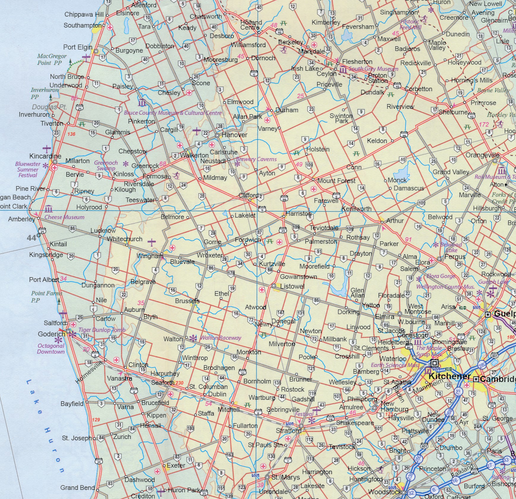
Een degelijke kaart voor Ontario met aanduidingen van o.a. nationale parken, vliegveld, benzinepomp, dirt-roads en kleine plattegrond van Toronto, Sault Ste. Marie. Als overzichtskaart goed te gebruiken.
Ontario and Quebec form the portion of Canada known as Central Canada. Ontario is the industrial heartland of the country, and the southern portion is the most densely-populated and urbanized part of Canada. Toronto is a city of 2.8M people and the heartland of an economic region serving 100,000,000 people in two countries. Southern Ontario is also home for six million residents, some of the most historic sites in the country, and major recreational land masses (Algonquin Park, Bruce Trail, Muskoka/Haliburton). Northern Ontario, on the other side of the map, occupies the bulk of the land area of the province, and is dominated by the Canadian Shield (a pre-Cambrian rock formation that is the oldest land on earth, rich in mineral wealth). The North is dominated by recreational activities, wilderness adventures, and mining tours. Ontario also has ports for ocean-going ships in Lake Superior and on James Bay. Very few Canadians have ever been to Polar Bear Provincial Park in the NE. Printed on paper, double-sided.
Double-sided map of Ontario, part of a series of maps of Canadian provinces from the Vancouver-based ITMB, with topography presented by altitude colouring rather than by relief shading. The map divides the province north-south, showing on one side the southern part 1:900,000, and on the reverse northern Ontario at 1:1,500,000.
Topography is indicated by altitude colouring, with spot heights plus graphics for marshlands. Plenty of rivers and lakes are shown, with the larger ones also named. Numerous national parks or provincial protected areas are highlighted and Indian reservations are marked.
The map shows the province’s road and rail networks, also indicating local airports in remote areas. Symbols highlight campsites, skiing areas, etc. The map has a latitude and longitude grid at intervals of 1º and is indexed
Reviews
Zeer snelle verzending vanuit een zeer groot assortiment. Prima.
★★★★★ door Bart Luttik 20 juli 2013Vond u dit een nuttige review? (login om te beoordelen)
Schrijf een review
Graag horen wij wat u van dit artikel vindt. Vindt u het goed, leuk, mooi, slecht, lelijk, onbruikbaar of erg handig: schrijf gerust alles op! Het is niet alleen leuk om te doen maar u informeert andere klanten er ook nog mee!
Ook interessant voor noord-amerika/canada/ontario
-

Vogelgids - Natuurgids Ontario Birds
€ 9,95Natuurgidsen Ontario -

Wegenkaart - landkaart - Stadsplatte
€ 13,95Stadsplattegronden Ontario -

Reisgids Trotter West-Canada | Lanno
€ 22,99Reisgidsen Alberta -

Wegenkaart - landkaart Southern Onta
€ 13,95Wegenkaarten Ontario -

Wegenatlas Quebec & Ontario | ITMB
€ 16,50Wegenatlassen Ontario