Footprint maps
 Wandelkaart Fort William | Footprint maps
Gedetailleerde wandelkaart van dit gedeelte van Schotland. Ook zeer geschikt voor de mountainbike. Op de achterzijde detailkaartjes met wandel- en mountainbikeroutes. Inclusief veel praktische informatie. This specially produced map & …
 Fietskaart The C2C Cycle Route - Coast to Coast | Footprint maps
- Britains most popular loing distance route. - New clear mapping, based on OS data,ata a scale of 1:90 000 - Waterproof paper and compact size - Excellent value for …
 Wegenkaart - landkaart Discover the Orkney Islands | Footprint maps
A group of islands close to the north coast of Scotland, Orkney has a visible history spanning more than 5500 years. From the world’s best preserved Neolithic settlement at Skara …
★★★★★ Wandelkaart The West Highland Way | Footprint maps
Handige wandelkaart van de bekende West Higland Way. Inclusief redelijk wat praktische informatie. The West Highland Way waterproof map from Footprint is a map-guide to the 95 mile (153km) route …
 Wandelkaart The Speyside Way | Footprint maps
The Speyside Way is one of 'Scotland's Great Trails'. It runs between Newtonmore, in the heart of Strathspey, 87 miles to Buckie, on the Moray Firth. The route passes through …
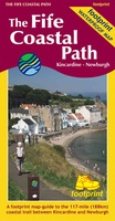 Wandelkaart The Fife Coastal Path | Footprint maps
A handy, waterproof map breaking down the Fife Pilgrim Way into seven sections. The Fife Pilgrim Way runs between North Queensferry or Culross and St Andrews. It is designed as …
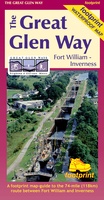 Wandelkaart The Great Glen Way | Footprint maps
The complete map/guide of both routes between Fort William and Inverness. Also contains compact and concise practical information for walkers. For every copy of this map sold, a …
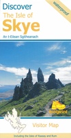 Wegenkaart - landkaart the isle of Skye | Footprint maps
Goede heldere overzichtskaart van het eiland Skye. Als wegenkaart prima te gebruiken, wandelroutes vind je er niet op terug. De wegen staan er duidelijk op ingetekend met wegnmmers en in …
★★★★★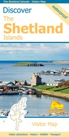 Wegenkaart - landkaart Discover the Shetlands Islands | Footprint maps
This map is the perfect companion to take for exploring the Shetland Islands. It is packed with lots of information on where to find the best that this group of …
★★★★★★★★★★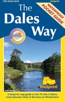 Wandelkaart The Dales Way | Footprint maps
Handzame wandelkaart voor de Dales Way in Noord Engeland. The Dales Way is a 79 mile (127km) long distance trail in the north of England, running between Ilkley, in North …
 Wandelkaart Discover Cairngorms National Park | Footprint maps
Since it was created in 2003 the Cairngorms National Park has provided the ultimate destination for visitors in the UK wanting to experience a unique mixture of wilderness and cultural …
 Wandelkaart The Fife Pilgrim Way | Footprint maps
A handy, waterproof map breaking down the Fife Pilgrim Way into seven sections. The Fife Pilgrim Way runs between North Queensferry or Culross and St Andrews. It is designed as …
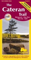 Wandelkaart The Cateran Trail | Footprint maps
Handige wandelkaart van de Cateran Trail. Inclusief redelijk wat praktische informatie. The Cateran Trail is a circular waymakred walk which runs from the town of Blairgowrie for 64 miles (103km) …
Laatste reviews

Prettige winkel. Veel keuze in gidsen. Gewoon goed en betrouwbaar
★★★★★ door Annie Roodenburg 14 mei 2024 | Heeft dit artikel gekocht
Vorig jaar al stuk in Denemarken gefietst. Dat smaakte naar meer. Dus nu de nog ontbrekende kaart aangeschaft. Dit zijn perfecte kaarten om op te …
★★★★★ door Nicolette Kroon 14 mei 2024 | Heeft dit artikel gekocht
kaart voldoet aaan hetgeen we nodig hebben . goeed overzicht door de kleuren en hoogte meters en vooral tekst groote voor onze aankomende fietsreis
★★★★★ door marc verschueren 13 mei 2024 | Heeft dit artikel gekocht
Mooie gedetailleerde kaart, duidelijk leesbaar, stevig, met handig plastic hoesje en extra boekje met tips en tochten.
★★★★★ door Chris 13 mei 2024 | Heeft dit artikel gekocht