Wales
 Reisgids South Wales - Zuid Wales | Bradt Travel Guides
Voor vele landen net zo goed, zo niet beter dan de Planet. Beduidend soberder uitgevoerd, maar ook met veel informatie voor backpackers en met veel kaartmateriaal. Een aanrader! This new …
 Reisgids Op roadtrip in Europa | Uitgeverij Zout
In Op roadtrip in Europa vind je 25 kant-en-klare routes in Europa die leuk zijn voor kinderen én hun ouders. Want hoe vind je tussen het grote aanbod de …
 Accommodatiegids Charming Small Hotel guide Britain and Ireland | Duncan
Engelstalige hotelgids voor Engeland, Schotland en Ierland: informatie over chique hotels, bed & breakfast, plattelands logeerhuizen en andere plekken om te overnachten. In totaal staan er zo'n 500 hotels in …
 Wegenkaart - landkaart Wales & southwest England | ITMB
Een degelijke kaart met aanduidingen van o.a. nationale parken, vliegveld, benzinepompen. Finally, we have been able to create our own map of the lovely country of Wales. I use the …
 Wandelgids Pembrokeshire North - Wales | Northern Eye Books
Zeer handzaam boekje van een tiental rondwandelingen, met goede kaarten en beschrijving. Leuke toevoeging op de route of als je alleen maar naar die streek gaat en op zoek bent …
 Wandelgids Scrambles in Scrambles in Snowdonia | Cicerone
This revised edition of Steve Ashton's classic guide presents 80 scrambles in the stunning Snowdonia National Park, offering challenge, adventure and exhilaration, but also breathtaking scenery and an unparalleled opportunity …
 Wandelgids 055 Pathfinder Guides Gower, Swansea and Cardiff | Ordnance Survey
Wandelgids van een deel van Engeland, Schotland of Wales. Deze gids bevat 28 dagwandelingen, variërend van korte tochten tot pittige dagtochten. De bijbehorende kaarten zijn uitstekend: men heeft de topografische …
 Fietsgids Wild Cycling | Little Brown
Compacte gids met 50 fietsroutes in de Britse wildernis. Met aanduiding van de moeilijkheid, hoogteprofielen en beschrijvingen van de fietstochten. Het kaartmateriaal is wel erg beperkt. Here is plenty …
 Wegenkaart - landkaart Road Map of Britain 2025 | Collins
Full-colour, double-sided road map of Great Britain at a scale of 8.7 miles to 1 inch. Northern England, Scotland and the Isle of Man are on one side with Southern …
 Wegenatlas Philip's Easy to Read Road Atlas of Britain 2025 | A3-Formaat | Paperback | Philip's Maps
With the detail you need at a size you can read, the latest edition of 2025 Philip's Big Easy to Read Road Atlas of Britain is super-clear, super-sized and bang …
 Wandelgids Day Walks Classic Day Walks in England & Wales | Vertebrate Publishing
Classic Day Walks in England & Wales features a selection of 20 of the best day-length hillwalking routes from Vertebrate Publishing's popular series of walking guidebooks. Edited by Jon Barton, …
 Reisgids Walks South Wales | Wild Things Publishing
28 magical walks through some of Wales' most popular mountain, lowland and coastal areas (the Brecon Beacons, Gower and Wye Valley). Classic walks that link multiple swim stops. Beautiful photography, …
 Reisgids PassePartout Wales | Edicola
Wie Wales zegt, zegt schitterende natuur, vriendelijke mensen en een rijke Keltische geschiedenis. Het land in het Verenigd Koninkrijk telt maar liefst drie nationale parken: het berggebied Snowdonia, de …
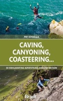 Reisgids Caving, Canyoning, Coasteering | Bradt Travel Guides
You don't need to be ultra-fit or highly experienced in the outdoors to enjoy outdoor guru Patrick Kinsella's selection of 30 activities across Britain. 'A sense of adventure and an …
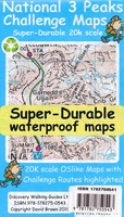 Wandelkaart National 3 Peaks Challenge Map | Discovery Walking Guides
Goede scheur- en watervaste wandelkaart. National 3 Peaks Challenge Maps. Ben Nevis, Scafell Pike and Snowdon at 20k scale. Waterproof, tearproof and 100% recyclable 820mm by 420mm double sided map …
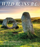 Reisgids Wild Ruins B.C.: The Explorer's Guide to Britain’s Ancient Sites | Wild Things Publishing
Discover Britain's extraordinary prehistory in this handbook to its wildest and most beautiful ancient remains. The sequel to the best-selling Wild Ruins, 18,000 copies sold. Wild ruins B.C. reveals the …
★★★★★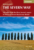 Wandelgids The Severn Way | Cicerone
Uitstekende wandelgids van de Severn Way, waarbij naast alle noodzakelijke informatie ook gebruik gemaakt wordt van de echte topografische kaart. Guidebook to walking the Severn Way, a 210 mile …
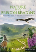 Natuurgids Nature of the Brecon Beacons | Pesda Press
Een gids met de meest voorkomende flora en fauna van de Brecon Beacons. Inclusief beschrijvingen en foto's. For most people wandering through the beautiful landscape of the Brecon Beacons …
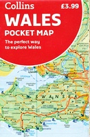 Wegenkaart - landkaart Pocket Map Wales | Collins
Kleine handzame kaart van Wales Handy little full colour map of Wales. Excellent value and very detailed for its size. Key features of this map include: • Clear mapping …
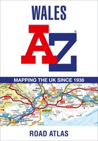 Wegenatlas Wales road atlas | A-Z Map Company
Handige wegenatlas op A5 formaat, makkelijk te gebruiken met grote letters en heel goed leesbaar. De schaal is behoorlijk gedetaileerd en zeker ook voor fietsers goed te gebruiken. Met veel …
Laatste reviews

Deze kaarten gebruik ik om mooie wandelingen uit te zetten, die ik dan met mijn liefste meisje beloop. Dank u wel voor de snelle adequate …
★★★★★ door Jacques Marks 03 december 2024 | Heeft dit artikel gekocht
Ook ik ben een zwerver, maar gelukkig niet dakloos. Deze kaarten gebruik ik om mooie wandelingen uit te zetten, die ik dan met mijn liefste …
★★★★★ door Jacques Marks 03 december 2024 | Heeft dit artikel gekocht
Perfect👍
★★★★★ door Wilma & Mari 03 december 2024 | Heeft dit artikel gekocht
Vooralsnog ben ik tevreden met de kaart. Hij werd vlot bezorgd en ik kan hem goed lezen. De echte proof of the pudding vindt echter …
★★★★★ door Jan Piebe Tjepkema 03 december 2024 | Heeft dit artikel gekocht