Yorkshire and the Humber
 Wandelgids Walking in the Yorkshire Dales: South and West | Cicerone
Veelzijdige wandelgids van een deel van de Yorkshire Dales, goede kaarten en beschrijvingen en veel keuze uit een behoorlijk aantal wandelingen. Part of a two-book set, this guidebook describes 44 …
 Wandelkaart Yorkshire 3 Peaks Challenge Map | Discovery Walking Guides
Goede scheur- en watervaste wandelkaart. OS 50k scale mapping is doubled in size to produce a 25k map but the features, text and logos are now doubled in size making …
 Wandelgids The North York Moors | Cicerone
Uitstekende wandelgids van dit geweldige gebied. Goed beschreven met veel praktische informatie om de routes te kunnen lopen, inclusief redelijke kaarten. Guidebook to 50 walks in the North York Moors …
 Wandelgids Coast to Coast Path: St Bees to Robin Hood's Bay | Trailblazer Guides
Goede wandelgids van de hele route van kust naar kust. Met veel details zijn alle etappes beschreven. Tevens informatie over overnachtingen en openbaar vervoer. All the information you need to …
★★★★★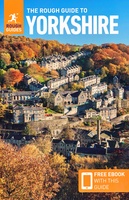 Reisgids Yorkshire | Rough Guides
Zeer goede reisgids voor zowel de georganiseerde maar vooral voor de zelfstandige reiziger. Boordevol informatie over reizen, slapen, eten, maar ook musea en cultuur. Voor Europese landen en steden completer …
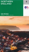 Wegenkaart - landkaart 4 OS Road Map Northern Engeland | Ordnance Survey
Een serie uitstekende wegenkaarten van Ordnance survey, de topografische dienst van Engeland. Alle 8 delen kennen een schaal van 1:250.000. Het kleurgebruik is uitbundig maar niet storend; integendeel, de hoogtes …
★★★★★★★★★★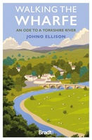 Reisverhaal Walking the Wharfe | Johno Ellison
In a world of globetrotting explorers and record-breaking journeys - of which he has been part himself - Johno Ellison decided to return to his roots and walk the entire …
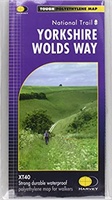 Wandelkaart Yorkshire Wolds Way | Harvey Maps
The Yorkshire Wolds Way is a 79 mile (127 km) walking route in the chalk landscape of the Yorkshire Wolds. The National Trail wends through some of the most tranquil …
 Wandelkaart Yorkshire Dales Noord-Oost | Harvey Maps
The Yorkshire Dales National Park on just 4 sheets. Yorkshire Dales North East: The coverage of this map includes Swaledale, Wharfedale, Wensleydale and Nidderdale. Genuine original HARVEY mapping at 1:25,000. …
 Wandelkaart National Trail Map Pennine Way | Collins
Overzichtskaart op vrij grove schaal van deze LAW Lange Afstands Wandeling in Engeland. Let op: je kunt er niet op lopen. Wel met veel informatie op de kaart, goed ingetekend, …
 Wegenkaart - landkaart Visitors map Yorkshire | A-Z Map Company
Explore the whole region of Yorkshire extending from Sheffield to Darlington. With detailed road mapping and illustrated town plans of major cities, this feature rich, helpful tourist guide is ideal …
 Wandelgids 28 Pathfinder Guides North York Moors | Ordnance Survey
Get lost in 28 beautiful walks exploring the North York Moors with the OS Pathfinder Guidebooks, graded by length and ranging from 3.5 to 11 miles. Make the most …
 Wandelgids Park Rangers Favourite Walks Yorkshire Dales | Collins
Compacte wandelgids met 20 wandelingen geselecteerd door park rangers en met duidelijke beschrijvingen en routekaartjes. Walking guide to the Yorkshire Dales National Park, with 20 best routes chosen by …
 Wegenkaart - landkaart National Park Pocket Map North York Moors | Collins
Handige kleine kaart van dit Nationaal Park. De kaart geeft een goed en helder overzicht van het gebied met alle plaatsen, doorgaande wandelpaden (alhoewel grof van schaal), bezienswaardigheden etc. Met …
 Wegenkaart - landkaart National Park Pocket Map Yorkshire Dales | Collins
Handige kleine kaart van dit Nationaal Park. De kaart geeft een goed en helder overzicht van het gebied met alle plaatsen, doorgaande wandelpaden (alhoewel grof van schaal), bezienswaardigheden etc. Met …
★★★★★ Reisgids York | Rough Guides
Handige pocketgids met enkele auto- en wandelroutes. Inspirational and informative new pocket guide, with free eBook, making the most of holidaying at home in the UK through clearly laid-out walks …
★★★★★★★★★★ Wandelgids Mountain Walks Yorkshire Three Peaks: | Vertebrate Publishing
Mountain Walks Yorkshire Three Peaks by Hannah Collingridge is a guide to walking routes on and around Pen-y-ghent, Ingleborough and Whernside in the Yorkshire Dales National Park. Alongside the routes …
 Wandelatlas Adventure Atlas Coast to Coast | A-Z Map Company
The A-Z Adventure Series is the perfect companion for walkers, off-road cyclists, and anyone wishing to explore the great outdoors. The Coast to Coast Walk (C2C) is one of …
 Reisgids 111 places in Places in Leeds That You Shouldn't Miss | Emons
Welcome to Leeds; a great northern powerhouse of a city which has reinvented itself from an industrial centre of wool, textiles and coal to one of the country’s biggest financial …
 Reisgids 111 places in Places in Yorkshire That You Shouldn't Miss | Emons
They call Yorkshire God’s own country. This is because England’s biggest county is also England’s most epic and most historically exciting. It has everything: unimaginably beautiful countryside, derelict castles, cliff-hugging …
Laatste reviews

Niet echt voor beginners. Ook zijn de routes soms moeilijk qua logistiek. Weer terugkomen aan het eind bv. En in voorseizoen (mei) blijft er niet …
★★★★★ door Tjeerd 17 mei 2024 | Heeft dit artikel gekocht
Van te voren had ik een andere kaart op het oog. Toen ik in de winkel was adviseerde zij mij deze kaart. Op hun verzoek …
★★★★★ door Koen 17 mei 2024 | Heeft dit artikel gekocht
Ideale schaal waar ook de kleinere wegen duidelijk zijn aangegeven. Beschrijving op website is correct.
★★★★★ door Peter 16 mei 2024 | Heeft dit artikel gekocht
Overzichtelijke kaart. Niks op aan te merken.
★★★★★ door Bastiaan de Leeuw 16 mei 2024 | Heeft dit artikel gekocht