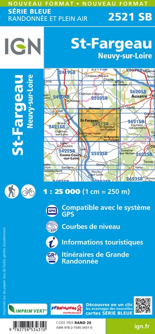
Wandelkaart - Topografische kaart 2521SB St-Fargeau, Neuvy-sur-Loire | IGN - Institut Géographique National (9782758534310)
Saint-Fargeau

- ISBN / CODE: 9782758534310
- Editie: meest recente versie
- Schaal: 1:25000
- Uitgever: IGN - Institut Géographique National
- Soort: Topografische kaart, Wandelkaart
- Serie: Serie bleue
- Taal: Frans
- Beoordeling: 5,0 ★★★★★ (1 review) Schrijf een review
-
€ 16,95
Leverbaar in 3 - 5 werkdagen in huis in Nederland Levertijd Belgie
Gratis verzending in Nederland vanaf €35,-

-
Topografische kaarten IGN 25.000 Bourgondië: West
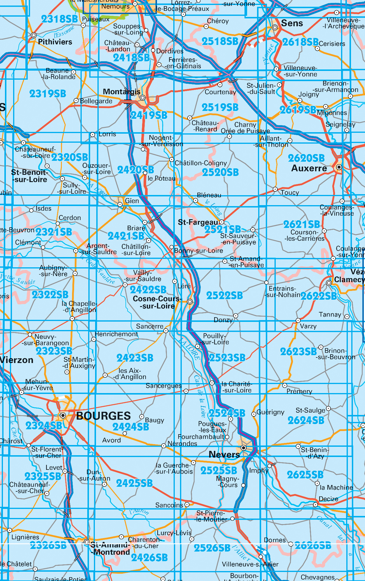
Producten op deze overzichtskaart:
Klik op een product om naar de pagina van dat product te gaan.
- Wandelkaart - Topografische kaart 2325SB Châteuneuf-sur-Cher, Levet | IGN - Institut Géographique National
- Topografische kaart - Wandelkaart 2326SB Saint-Amand-Montrond | IGN - Institut Géographique National
- Wandelkaart - Topografische kaart 2419SB Montargis - Lorris | IGN - Institut Géographique National
- Wandelkaart - Topografische kaart 2420SB Châtillon-Coligny, Nogent-sur-Vernisson | IGN - Institut Géographique National
- Wandelkaart - Topografische kaart 2421SB Briare | IGN - Institut Géographique National
- Wandelkaart - Topografische kaart 2422SB St-Satur, Léré, Vailly-sur-Sauldre | IGN - Institut Géographique National
- Wandelkaart - Topografische kaart 2423SB Les Aix-d'Angillon - Sancerre | IGN - Institut Géographique National
- Wandelkaart - Topografische kaart 2424SB Nérondes - Avord | IGN - Institut Géographique National
- Wandelkaart - Topografische kaart 2425SB Dun-sur-Aubron - Blet | IGN - Institut Géographique National
- Topografische kaart - Wandelkaart 2426SB Charenton-du-Cher | IGN - Institut Géographique National
- Wandelkaart - Topografische kaart 2519SB Courtenay, Château-Renard | IGN - Institut Géographique National
- Wandelkaart - Topografische kaart 2520SB Champignelles, Bléneau, Charny Orée de Puisaye | IGN - Institut Géographique National
- Wandelkaart - Topografische kaart 2521SB St-Fargeau, Neuvy-sur-Loire | IGN - Institut Géographique National
- Wandelkaart 2522SB Cosne-Cours-sur-Loire - Donzy | IGN
- Topografische kaart - Wandelkaart 2523SB La Charité-sur-Loire | IGN - Institut Géographique National
- Wandelkaart - Topografische kaart 2524SB Nevers, Jouet-sur-l'Aubois | IGN - Institut Géographique National
- Wandelkaart - Topografische kaart 2525SB La Guerche-sur-l'Aubois, Sancoins, Magny-Cours | IGN - Institut Géographique National
- Topografische kaart - Wandelkaart 2526SB Lurcy-Lévis | IGN - Institut Géographique National
- Wandelkaart - Topografische kaart 2618SB Sens | IGN - Institut Géographique National
- Wandelkaart - Topografische kaart 2619SB Joigny | IGN - Institut Géographique National
- Wandelkaart - Topografische kaart 2620SB Auxerre - Toucy | IGN - Institut Géographique National
- Topografische kaart - Wandelkaart 2621SB Courson-les-Carrières, Thury | IGN - Institut Géographique National
- Wandelkaart - Topografische kaart 2622SB Clamecy - Varzy | IGN - Institut Géographique National
- Topografische kaart - Wandelkaart 2623SB Prémery | IGN - Institut Géographique National
- Wandelkaart - Topografische kaart 2624SB St-Benin-D'Azy – St-Saulge | IGN - Institut Géographique National
- Wandelkaart - Topografische kaart 2625SB Decize - Imphy | IGN - Institut Géographique National
- Wandelkaart - Topografische kaart 2626SB Dornes | IGN - Institut Géographique National
-
Wandelkaarten IGN 25.000 Bourgondië: West


Producten op deze overzichtskaart:
Klik op een product om naar de pagina van dat product te gaan.
- Wandelkaart - Topografische kaart 2325SB Châteuneuf-sur-Cher, Levet | IGN - Institut Géographique National
- Topografische kaart - Wandelkaart 2326SB Saint-Amand-Montrond | IGN - Institut Géographique National
- Wandelkaart - Topografische kaart 2419SB Montargis - Lorris | IGN - Institut Géographique National
- Wandelkaart - Topografische kaart 2420SB Châtillon-Coligny, Nogent-sur-Vernisson | IGN - Institut Géographique National
- Wandelkaart - Topografische kaart 2421SB Briare | IGN - Institut Géographique National
- Wandelkaart - Topografische kaart 2422SB St-Satur, Léré, Vailly-sur-Sauldre | IGN - Institut Géographique National
- Wandelkaart - Topografische kaart 2423SB Les Aix-d'Angillon - Sancerre | IGN - Institut Géographique National
- Wandelkaart - Topografische kaart 2425SB Dun-sur-Aubron - Blet | IGN - Institut Géographique National
- Topografische kaart - Wandelkaart 2426SB Charenton-du-Cher | IGN - Institut Géographique National
- Wandelkaart - Topografische kaart 2519SB Courtenay, Château-Renard | IGN - Institut Géographique National
- Wandelkaart - Topografische kaart 2520SB Champignelles, Bléneau, Charny Orée de Puisaye | IGN - Institut Géographique National
- Wandelkaart - Topografische kaart 2521SB St-Fargeau, Neuvy-sur-Loire | IGN - Institut Géographique National
- Wandelkaart 2522SB Cosne-Cours-sur-Loire - Donzy | IGN
- Topografische kaart - Wandelkaart 2523SB La Charité-sur-Loire | IGN - Institut Géographique National
- Wandelkaart - Topografische kaart 2524SB Nevers, Jouet-sur-l'Aubois | IGN - Institut Géographique National
- Wandelkaart - Topografische kaart 2525SB La Guerche-sur-l'Aubois, Sancoins, Magny-Cours | IGN - Institut Géographique National
- Topografische kaart - Wandelkaart 2526SB Lurcy-Lévis | IGN - Institut Géographique National
- Wandelkaart - Topografische kaart 2618SB Sens | IGN - Institut Géographique National
- Wandelkaart - Topografische kaart 2619SB Joigny | IGN - Institut Géographique National
- Wandelkaart - Topografische kaart 2620SB Auxerre - Toucy | IGN - Institut Géographique National
- Topografische kaart - Wandelkaart 2621SB Courson-les-Carrières, Thury | IGN - Institut Géographique National
- Wandelkaart - Topografische kaart 2622SB Clamecy - Varzy | IGN - Institut Géographique National
- Topografische kaart - Wandelkaart 2623SB Prémery | IGN - Institut Géographique National
- Wandelkaart - Topografische kaart 2624SB St-Benin-D'Azy – St-Saulge | IGN - Institut Géographique National
- Wandelkaart - Topografische kaart 2625SB Decize - Imphy | IGN - Institut Géographique National
- Wandelkaart - Topografische kaart 2626SB Dornes | IGN - Institut Géographique National
Overzichtskaarten
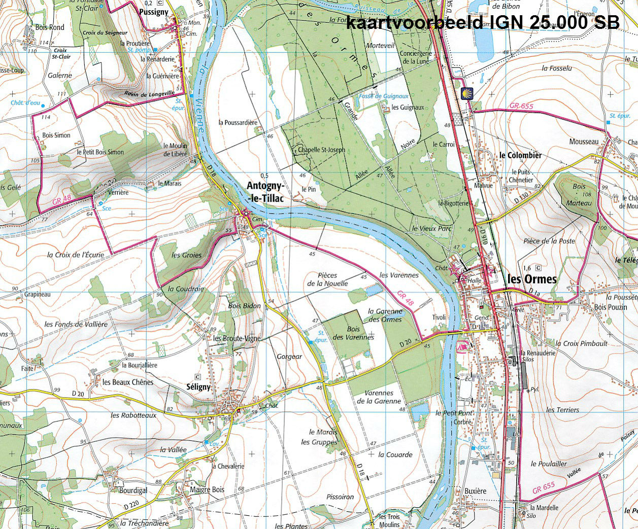
Beschrijving
Reviews
Fijn, dat twee kaarten samengevoegd zijn tot één, nu hoeven we niet steeds van de ene kaart over stappen op de volgende kaart! Alle informatie die ik wil hebben over alles wat je al wandelend of fietsend tegenkomt, staat er op aangegeven. Meer hebben we niet nodig, fijne en handige kaart!
★★★★★ door Tiemen Steenbeek 3 juni 2016Vond u dit een nuttige review? (login om te beoordelen)
Schrijf een review
Graag horen wij wat u van dit artikel vindt. Vindt u het goed, leuk, mooi, slecht, lelijk, onbruikbaar of erg handig: schrijf gerust alles op! Het is niet alleen leuk om te doen maar u informeert andere klanten er ook nog mee!
Ook interessant voor europa/frankrijk/bourgondie
-

Wandelkaart - Topografische kaart 25
€ 16,95Topografische kaarten Bourgondië - Morvan -

Topografische kaart - Wandelkaart 25
€ 16,95Topografische kaarten Bourgondië - Morvan -

Wandelkaart - Topografische kaart 26
€ 16,95Topografische kaarten Bourgondië - Morvan -

Fietskaart - Wegenkaart - landkaart
€ 10,95Fietskaarten Bourgondië - Morvan -

Topografische kaart - Wandelkaart 29
€ 16,95Topografische kaarten Bourgondië - Morvan