Kaarten - Ierland
 Topografische kaart - Wandelkaart 77 Discovery Wexford | Ordnance Survey Ireland
Zeer gedetailleerde topografische kaart met een aantal toegevoegde toeristische symbolen voor bijv. bezienswaardigheden, campings en jeugdherbergen. Met hoogtelijnen, mooi kleurgebruik en ingetekende lange-afstands-wandelroutes. Op deze kaart zijn de nationale parken …
 Topografische kaart - Wandelkaart 78 Discovery Kerry | Ordnance Survey Ireland
Zeer gedetailleerde topografische kaart met een aantal toegevoegde toeristische symbolen voor bijv. bezienswaardigheden, campings en jeugdherbergen. Met hoogtelijnen, mooi kleurgebruik en ingetekende lange-afstands-wandelroutes. Op deze kaart zijn de nationale parken …
★★★★★★★★★★ Topografische kaart - Wandelkaart 79 Discovery Cork, Kerry | Ordnance Survey Ireland
Zeer gedetailleerde topografische kaart met een aantal toegevoegde toeristische symbolen voor bijv. bezienswaardigheden, campings en jeugdherbergen. Met hoogtelijnen, mooi kleurgebruik en ingetekende lange-afstands-wandelroutes. Op deze kaart zijn de nationale parken …
 Topografische kaart - Wandelkaart 80 Discovery Cork | Ordnance Survey Ireland
Zeer gedetailleerde topografische kaart met een aantal toegevoegde toeristische symbolen voor bijv. bezienswaardigheden, campings en jeugdherbergen. Met hoogtelijnen, mooi kleurgebruik en ingetekende lange-afstands-wandelroutes. Op deze kaart zijn de nationale parken …
 Topografische kaart - Wandelkaart 81 Discovery Cork, Waterford | Ordnance Survey Ireland
Zeer gedetailleerde topografische kaart met een aantal toegevoegde toeristische symbolen voor bijv. bezienswaardigheden, campings en jeugdherbergen. Met hoogtelijnen, mooi kleurgebruik en ingetekende lange-afstands-wandelroutes. Op deze kaart zijn de nationale parken …
 Topografische kaart - Wandelkaart 82 Discovery Waterford | Ordnance Survey Ireland
Zeer gedetailleerde topografische kaart met een aantal toegevoegde toeristische symbolen voor bijv. bezienswaardigheden, campings en jeugdherbergen. Met hoogtelijnen, mooi kleurgebruik en ingetekende lange-afstands-wandelroutes. Op deze kaart zijn de nationale parken …
 Topografische kaart - Wandelkaart 83 Discovery Kerry (Caherciveen) | Ordnance Survey Ireland
Zeer gedetailleerde topografische kaart met een aantal toegevoegde toeristische symbolen voor bijv. bezienswaardigheden, campings en jeugdherbergen. Met hoogtelijnen, mooi kleurgebruik en ingetekende lange-afstands-wandelroutes. Op deze kaart zijn de nationale parken …
 Topografische kaart - Wandelkaart 84 Discovery Cork, Kerry | Ordnance Survey Ireland
Zeer gedetailleerde topografische kaart met een aantal toegevoegde toeristische symbolen voor bijv. bezienswaardigheden, campings en jeugdherbergen. Met hoogtelijnen, mooi kleurgebruik en ingetekende lange-afstands-wandelroutes. Op deze kaart zijn de nationale parken …
★★★★★★★★★★ Topografische kaart - Wandelkaart 86 Discovery Cork (Bandon) | Ordnance Survey Ireland
Zeer gedetailleerde topografische kaart met een aantal toegevoegde toeristische symbolen voor bijv. bezienswaardigheden, campings en jeugdherbergen. Met hoogtelijnen, mooi kleurgebruik en ingetekende lange-afstands-wandelroutes. Op deze kaart zijn de nationale parken …
 Topografische kaart - Wandelkaart 87 Discovery Cork (Kinsale) | Ordnance Survey Ireland
Zeer gedetailleerde topografische kaart met een aantal toegevoegde toeristische symbolen voor bijv. bezienswaardigheden, campings en jeugdherbergen. Met hoogtelijnen, mooi kleurgebruik en ingetekende lange-afstands-wandelroutes. Op deze kaart zijn de nationale parken …
 Topografische kaart - Wandelkaart 88 Discovery Cork (Dunmanus Bay) | Ordnance Survey Ireland
Zeer gedetailleerde topografische kaart met een aantal toegevoegde toeristische symbolen voor bijv. bezienswaardigheden, campings en jeugdherbergen. Met hoogtelijnen, mooi kleurgebruik en ingetekende lange-afstands-wandelroutes. Op deze kaart zijn de nationale parken …
 Topografische kaart - Wandelkaart 89 Discovery Cork (Skibbereen) | Ordnance Survey Ireland
Zeer gedetailleerde topografische kaart met een aantal toegevoegde toeristische symbolen voor bijv. bezienswaardigheden, campings en jeugdherbergen. Met hoogtelijnen, mooi kleurgebruik en ingetekende lange-afstands-wandelroutes. Op deze kaart zijn de nationale parken …
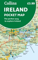 Wegenkaart - landkaart Pocket Map Ireland pocket map - Ierland | Collins
Kleine handzame kaart van Ierland. Explore Ireland with this handy, full colour map. Handy little full colour map of Ireland at an excellent price. It is double-sided, with the …
★★★★★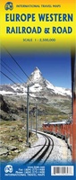 Spoorwegenkaart Europe Western Railroad & Road | ITMB
Spoorwegen kaart van West Europa in kleur. Schaal 1:2,500,000. Toont spoorlijnen, snelwegen, secundaire wegen en andere wegen, veerboten en belangrijke scheepvaartdiensten; internationale grenzen, de grenzen van de gebieden met reisbeperkingen; …
★★★★★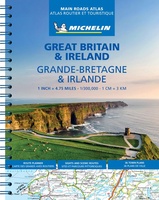 Wegenatlas Great Britain and Ireland 2024 - Main Roads Atlas (A4-Spiral) | Michelin
Full of practical features, the Michelin Great Britain & Ireland 2024 - Main Roads Atlas (A4-Spiral) is the perfect companion for your everyday journey and holiday planning. Updated every year, …
★★★★★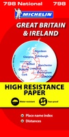 Wegenkaart - landkaart 798 Great Britain & Ireland | Michelin
Scheur- en watervast! Zoals je van Michelin mag verwachten is deze kaart zeer overzichtelijk en heeft een duidelijk helder kaartbeeld. De kaart geeft uitgebreid toeristische informatie weer. Met register, …
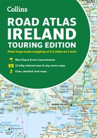 Wegenatlas Road Atlas Ireland | Collins
Explore Ireland with this accurate and fully updated road atlas. This road atlas is at A4 size, covering the whole of Ireland and features clear and detailed Collins colour mapping …
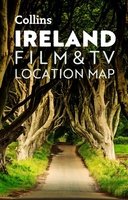 Wegenkaart - landkaart Pocket Map Ireland Film and TV Location Map | Collins
Full-colour, handy guide to more than 50 of the most popular film and TV locations in Ireland. Striking images and detailed descriptions allow for a comprehensive guide to Ireland's most …
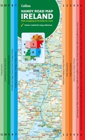 Wegenkaart - landkaart Map of Ireland Handy | Collins
Explore new places with this comprehensive map of Ireland from Collins. An easy-to-use route-planning map covering the whole of Ireland. It has the convenience of an atlas with all the …
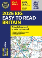 Wegenatlas Philip's Easy to Read Road Atlas of Britain 2025 | A3-Formaat | Paperback | Philip's Maps
With the detail you need at a size you can read, the latest edition of 2025 Philip's Big Easy to Read Road Atlas of Britain is super-clear, super-sized and bang …
Laatste reviews

De landkaart voldoet geheel aan mijn wensen. Ik zocht en zo klein mogelijke schaal, om onze routes te plannen. Helaas is de eerste bestelling verdwenen …
★★★★★ door Albert Huizing 04 januari 2025 | Heeft dit artikel gekocht
Prachtige foto’s die herkenbaar zijn na een bezoek aan Suriname. Interessante achtergrond informatie. Jammer dat het boek niet meer gedrukt wordt. Snel verstuurd!
★★★★★ door Neeltje 03 januari 2025 | Heeft dit artikel gekocht
Ik kocht dit boek voor pakjesavond voor mijn zwager en schoonzus, die het heerlijk vinden om regelmatig samen te wandelen, ergens in Nederland. Ook houden …
★★★★★ door Cindy de Lange-Wirds 03 januari 2025 | Heeft dit artikel gekocht
O.a. en kaart van Curaçao besteld. Prachtig van kwaliteit maar wel wat jammer dat de uitvoering wat gedateerd is. Reisgids is prima, evenals het fietsboekje …
★★★★★ door Henk van den Born 03 januari 2025 | Heeft dit artikel gekocht