Kaarten - Schotland
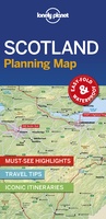 Wegenkaart - landkaart Planning Map Scotland - Schotland | Lonely Planet
Durable and waterproof, with a handy slipcase and an easy-fold format, Lonely Planet's Scotland Planning Map helps you get around with ease. Get more from your map and your …
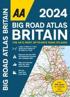 Wegenatlas Big Road Atlas Britain 2025 - A3 | Ringband | AA Publishing
This best-selling A3 format atlas is available in two binding styles; paperback and spiral bound. Up-to-date mapping from the experts at the AA this atlas has large 3 miles to …
★★★★★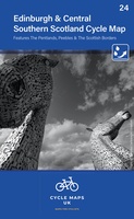 Fietskaart 24 Cycle Maps UK Edinburgh - Central Southern Scotland | Cordee
Een nieuwe fietskaarten serie van Groot-Brittannië. Gedrukt op scheur- en watervast papier en mooi handzaam klein formaat. Deze kaarten zijn met name heel goed om de Lange Afstands Fietsroutes (LF) …
★★★★★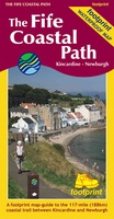 Wandelkaart The Fife Coastal Path | Footprint maps
A handy, waterproof map breaking down the Fife Pilgrim Way into seven sections. The Fife Pilgrim Way runs between North Queensferry or Culross and St Andrews. It is designed as …
 Wandelkaart Cairn Gorm | Harvey Maps
Includes 18 Munros of which 5 over 4000' (Cairn Gorm, Ben Macdui, Cairn Toul, Braeriach & Sgor an Loachain Uaine) and 3 Corbetts. Detailed map for hillwalkers of the …
 Wegenkaart - landkaart Great Britain OS route | Ordnance Survey
Tweezijdige overzichtskaart van heel Engeland en Schotland. Goed duildelijk leesbaar kaartbeeld met de doorgaande en grotere wegen. Ook Nationsle Parken staan er goed op. Ordnance Survey's double-sided OS Route Map …
 Wandelkaart John O'Groats trail | Harvey Maps
Mooie, duidelijke kaart van de John O'Groats trail in Schotland. Geplastificeerd met veel extra informatie en uitsnedes van de route. The John o' Groats Trail is a 237 km (147 …
★★★★★★★★★★ Spoorwegenkaart Europe Western Railroad & Road | ITMB
Spoorwegen kaart van West Europa in kleur. Schaal 1:2,500,000. Toont spoorlijnen, snelwegen, secundaire wegen en andere wegen, veerboten en belangrijke scheepvaartdiensten; internationale grenzen, de grenzen van de gebieden met reisbeperkingen; …
★★★★★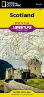 Wegenkaart - landkaart 3326 Adventure Map Scotland - Schotland | National Geographic
Wegenkaart van Schotland met vermelding van veel bezienswaardigheden, nationale parken en attrakties. Watervast en scheurvast. Juist door deze vermeldingen onderscheidt de kaart zich van andere wegenkaarten. National Geographic's Scotland AdventureMapis …
★★★★★★★★★★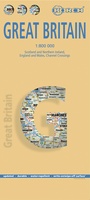 Wegenkaart - landkaart Groot - Brittannië | Borch
Mooie geplasticieerde kaart van Groot - Brittanië. Deze kaart biedt een goed overzicht van het land met detailkaarten. Our soft-laminated folded map of Great Britain shows: Scotland and Northern …
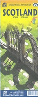 Wegenkaart - landkaart Scotland - Schotland | ITMB
Anyone who has been in this business for a few years remembers Ordnance Survey and their brilliantly detailed artwork. They should also remember that OS guarded this artwork religiously. That …
★★★★★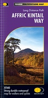 Wandelkaart Affric Kintail Way | Harvey Maps
Mooie, duidelijke kaart van de Affric Kintail way in Schotland. Geplastificeerd met veel extra informatie en uitsnedes van de route. De hele rote op 1 kaart, erg handig! The Affric …
★★★★★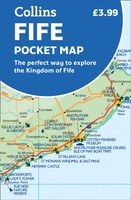 Wegenkaart - landkaart Pocket Map Fife | Collins
Handy little full colour map of the coastal Kingdom of Fife. Detailed mapping and tourist information from Dundee in the North to Edinburgh in the south and from Fife coast …
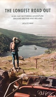 Wegenkaart - landkaart Routemap The Longest Road Out | Longestroadout
Deze kaart hoort bij het boek The Longest Road Out
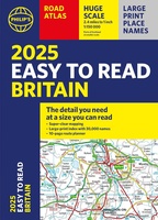 Wegenatlas Easy to Read Road Atlas Britain 2025 | Philip's Maps
"The detail you need at a size you can read". The latest 2025 Philip's Easy to Read Road Atlas of Britain from the best-selling Road Atlas range has over 350 …
★★★★★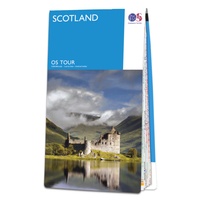 Wegenkaart - landkaart 12 Tour Map Scotland | Ordnance Survey
If you are on holiday and looking for a simple map containing all the information you need to make the most of your visit, the Tour maps are for you. …
★★★★★ Fietskaart The Ultimate UK Cycle Route Planner | Excellent Books
Fully updated and revised 4th edition for 2022 with an increased sheet size. One of the best selling UK cycle publications giving an overview of all the main signed UK …
★★★★★ Wandelkaart West Highland Way | Harvey Maps
Wandelkaart van de West Highland Way met uitsnedes van de route. Leap forward in technical excellence. Tough, light and 100% wateproof. Compact and light - the map itself weighs just …
★★★★★ Wegenkaart - landkaart Malt Whisky Map of Scotland | Waverley Books
Een bijzondere kaart van Schotland met alle whisky distilleerderijen in het land weergegeven. The Malt Whisky Map of Scotland is a special map designed by Neil Wilson and James …
 Wegenatlas Glovebox Atlas Scotland - Schotland | AA Publishing
This handy road atlas fits the glovebox of your car, perfect for quick referencing on the move. Including information on route planning, car ferry routes and operators, restricted motorway junctions, …
Laatste reviews

Kan de huidige ontstuimige ontwikkelingen wereldwijd, nu ook geografisch plaatsen en daarmee beter volgen.
★★★★★ door Leo Janssen 20 december 2024 | Heeft dit artikel gekocht
We hadden Piëmonte al eens bezocht en voor onze komende reis werd ons door kennissen deze gids aanbevolen. Inderdaad is dit een heel goede gids. …
★★★★★ door DWKdB 19 december 2024 | Heeft dit artikel gekocht
Mijn bestellingen zijn altijd goed en worden altijd op tijd geleverd. Komen afspraken goed na. Erg tevreden.
★★★★★ door Ben Wegdam 19 december 2024 | Heeft dit artikel gekocht
Zeer gedetailleerde kaart van het zuidelijke deel van het douaniers pad
★★★★★ door Marian 18 december 2024 | Heeft dit artikel gekocht