Wandelgidsen - Lowlands | Schotse Laaglanden en grenzen
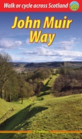 Wandelgids John Muir Way | Rucksack Readers
The John Muir Way runs for 134 miles (215 km) coast-to-coast across central Scotland, from Helensburgh on the Clyde to Dunbar on the North Sea. The route is as suitable …
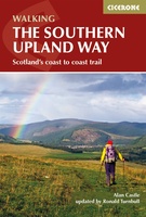 Wandelgids The Southern Upland Way | Cicerone
Uitstekende wandelgids van de Southern Upland Way, waarbij naast alle noodzakelijke informatie ook gebruik gemaakt wordt van de echte topografische kaart. The Southern Upland Way is Scotland's coast-to-coast walk …
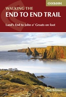 Wandelgids Walking The End to End Trail | Cicerone
Een droomroute voor velen: helemaal van het zuidelijkste puntje van Engeland naar het noordelijkste puntje van Schotland, zo'n slordige 1956 km door fabelachtig mooie afwisselende landschappen. Zeer gedetailleerd beschreven met …
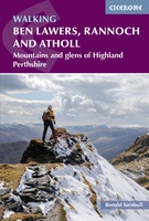 Wandelgids Walking Ben Lawers, Rannoch and Atholl | Cicerone
Wandelgids met 80 wandelingen van verschillende niveaus in het gebied van de Perthshire Highlands. The south-eastern Grampians of the former county of Perthshire may be grassier and less rugged than …
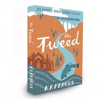 Wandelgids The Tweed | Pocket Mountains
Handige compacte wandelgids met 40 dagwandelingen. Deze gids bevat kleine kaartjes en leuke uitgebreide informatie over wat er langs de route te zien is. Goede wandelkaarten zijn echter we noodzakelijk …
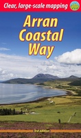 Wandelgids The Arran Coastal Way | Rucksack Readers
The Arran Coastal Way is perhaps Scotland's finest circular long-distance trail, running 65 miles (105 km) around the Isle of Arran in a memorable week-long hike from Brodick. It's accessible …
★★★★★★★★★★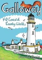 Wandelgids Galloway | Pocket Mountains
Handige compacte wandelgids met 40 dagwandelingen. Deze gids bevat kleine kaartjes en leuke uitgebreide informatie over wat er langs de route te zien is. Goede wandelkaarten zijn echter we noodzakelijk …
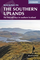 Wandelgids Walking in the Southern Uplands | Cicerone
This guidebook describes 44 routes and over 100 summits stretching across the Southern Uplands of Scotland, stretching south-west from Edinburgh to the English border, including the Galloway and Pentland Hills. …
 Wandelgids Arran | Pocket Mountains
Handige compacte wandelgids met 40 dagwandelingen. Deze gids bevat kleine kaartjes en leuke uitgebreide informatie over wat er langs de route te zien is. Goede wandelkaarten zijn echter wel aan …
 Wandelgids The Borders Abbeys Ways | Cicerone
Uitstekende wandelgids van de Borders Abbeys Way, waarbij naast alle noodzakelijke informatie ook gebruik gemaakt wordt van de echte topografische kaart. Guidebook to the Borders Abbeys Way, a 68 mile …
 Wandelgids Mountain Walks in Loch Lomond and the Trossachs | Northern Eye Books
One of four books in the popular Loch Lomond and The Trossachs: Top 10 Walks series. Handy, pocket-sized, full colour walking guides written by experts. The perfect impulse buy. The …
 Wandelgids Ayrshire and Arran Coastal Paths | Cicerone
A guide to walking or backpacking along the Ayrshire and Arran Coastal Paths, which stretch for over 150 miles along the stunning west coast of Scotland, within easy reach of …
 Wandelgids Hadrian's Wall path | Rucksack Readers
Uitgevoerd in de vorm van een klapper, met ringband geeft deze gids een goede beschrijving van de lange afstands route. De kaarten zijn schetsmatig maar wel duidelijk. Hadrian's Wall …
★★★★★ Wandelgids Walking the Galloway Hills | Cicerone
Uitstekende wandelgids van galloway! This guide covers 35 day walks and one long-distance route in the wild and remote hills of Galloway. Although there are some shorter and easier …
 Wandelgids Walking in the Scottish Borders | Cicerone
This guidebook provides 45 day walks in the Scottish Borders. Separated into six sections, these walks are divided between the north and south Cheviots, Tweed, Ettrick, Moffat and Manor hills …
 Wandelgids The Clyde | Pocket Mountains
Handige compacte wandelgids met 40 dagwandelingen. Deze gids bevat kleine kaartjes en leuke uitgebreide informatie over wat er langs de route te zien is. Goede wandelkaarten zijn echter we noodzakelijk …
 Wandelgids The Dumfriesshire Dales | Pocket Mountains
Handige compacte wandelgids met 40 dagwandelingen. Deze gids bevat kleine kaartjes en leuke uitgebreide informatie over wat er langs de route te zien is. Goede wandelkaarten zijn echter we noodzakelijk …
 Wandelgids 1 Walking the Corbetts: Volume 1 | Cicerone
Uitstekende wandelgids, goed beschreven met veel praktische informatie om de route te kunnen lopen, inclusief redelijke kaarten. This guide describes routes up all 112 Corbetts south of the Great Glen. …
 Wandelgids West Lothian | Pocket Mountains
Handige compacte wandelgids met 40 dagwandelingen. Deze gids bevat kleine kaartjes en leuke uitgebreide informatie over wat er langs de route te zien is. Goede wandelkaarten zijn echter we noodzakelijk …
 Wandelgids Annandale Way | Rucksack Readers
The Annandale Way is a charming long walk in a little-known, but very accessible, part of southern Scotland. Walked southward from source to the sea, it starts in the sheep …
Laatste reviews

Deze waszak,opgevouwen als klein plat tasje,cadeau gegeven. De ontvanger was er superblij mee. Hij gaat binnenkort mee op een verre reis. Extra leuk dat de …
★★★★★ door Fina 30 december 2024 | Heeft dit artikel gekocht
Heel informatief
★★★★★ door Annelies 30 december 2024 | Heeft dit artikel gekocht
Zeer matige papier-kwaliteit. We hebben er alleen thuis nog op gekeken maar in de hoeken scheurt het papier al. We wandelen regelmatig hier en het …
★★★★★ door fred stassen 30 december 2024 | Heeft dit artikel gekocht
helpdesk was efficiënt en vriendelijk
★★★★★ door Sylvia 30 december 2024 | Heeft dit artikel gekocht