Kaarten - Noord-Amerika
 Stadsplattegrond Fleximap San Francisco | Insight Guides
Geplastificeerde centrumkaart van San Francisco, met register. Voor de 'gewone' toerist een handige kaart, geen groot formaat, overzichtelijk met alle belangrijke plaatsen van de stad goed weergegeven. Kaart van San …
★★★★★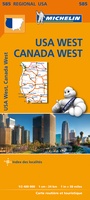 Wegenkaart - landkaart 585 Western USA - Western Canada | Michelin
Wegenkaart van het westelijke gedeelte van de USA (zuid tot bovenste stukje Mexico, oost tot ongeveer Denver/ Regina) en westelijk Canada (t/m Edmonton in het noorden). Zie uitsnede op de …
★★★★★★★★★★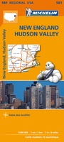 Wegenkaart - landkaart 581 New England - Hudson Valley | Michelin
Zoals je van Michelin mag verwachten zijn het onmisbare overzichtskaarten van een uitstekende kwaliteit: een duidelijk en goed leesbaar kaartbeeld. Vrijwel alle berijdbare wegen staan er op ingetekend, in kleur …
★★★★★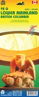 Wegenkaart - landkaart 92G Lower Mainland British Columbia - Richmond and New Westminster | ITMB
Goede wegenkaart van British Columbia met topografische uitsnede van Richmond en Westminster. Topographic/Recreation Map 92G&92G2 and G3 - With the 2010 Winter Olympics bearing down on us, this very timely …
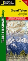 Wandelkaart 202 Grand Teton National Park | National Geographic
Prachtige geplastificeerde kaart van het bekende nationaal park. Met alle recreatieve voorzieningen als campsites, maar ook met topografische details en wandelroutes ed. Door uitgekiend kleurgebruik zeer prettig in gebruik. Scheur …
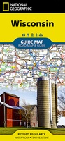 Wegenkaart - landkaart State Guide Map Wisconsin | National Geographic
Makkelijk leesbare kaart aan 2 zijden bedrukt. De ene kan met informatie en beperkte stadsplattegronden, de andere met de daadwerkelijke kaart. De kaart is geplastificeerd en dus watervast! The front …
★★★★★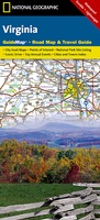 Wegenkaart - landkaart State Guide Map Virginia | National Geographic
Makkelijk leesbare kaart aan 2 zijden bedrukt. De ene kan met informatie en beperkte stadsplattegronden, de andere met de daadwerkelijke kaart. De kaart is geplastificeerd en dus watervast! The front …
★★★★★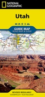 Wegenkaart - landkaart State Guide Map Utah | National Geographic
Makkelijk leesbare kaart aan 2 zijden bedrukt. De ene kant met informatie en beperkte stadsplattegronden, de andere met de daadwerkelijke kaart. De kaart is geplastificeerd en dus watervast! The front …
★★★★★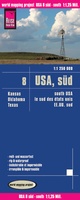 Wegenkaart - landkaart 8 USA Zuid: Texas, Oklahoma, Kansas | Reise Know-How Verlag
Tweetalige kaart (Engels en Duits). Door ingetekende lengte- en breedtegraden is het gebruik van GPS mogelijk. Met hoogtelijnen en uitgebreid wegennetwerk: daarnaast worden ook de afstanden tussen belangrijke plaatsen duidelijk …
★★★★★ Wegenkaart - landkaart Kalifornien - Californië | Freytag & Berndt
Goede tweezijdige wegenkaart van de hele staat. Met register en enkele stadsplattegronden. De berijdbare wegen zijn goed weergeven, zowel de hoofdwegen als provinciale en lokale wegen; wegnummers worden vermeld. Afstanden …
★★★★★ Stadsplattegrond Orlando | Borch
Borch Orlando is een duidelijke, geplastificeerde plattegrond van het centrum met informatie over openbaar vervoer en bezienswaardigheden. Inclusief straatnamenregister. Our soft-laminated folded map of Orlando shows: Orlando Downtown 1:11 …
★★★★★★★★★★ Wegenkaart - landkaart USA Northeast - USA Noordoost | Hildebrand's
Wegenkaart van het Noordoosten Verenigde Staten van Amerika schaal 1:700.000 Gedetailleerde wegenkaart met wegnummers, toeristische informatie, afstandstabel, en inzetjes met de stadsplattegrond van Boston, New York/Manhattan, Philadelphia, Baltimore, Washington, Buffalo, …
★★★★★ Wegenkaart - landkaart Sunshine Coast - British Columbia | ITMB
Mooi autokaart in overzichtelijke kleur van ITMB. Indexed. English text and legends. The coastline of Canada’s British Columbia is long and varied. The best-known portion is the part just north …
★★★★★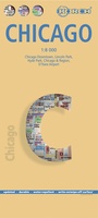 Stadsplattegrond Chicago | Borch
Borch Chicago is een duidelijke, geplastificeerde plattegrond van het centrum met informatie over openbaar vervoer en bezienswaardigheden. Inclusief straatnamenregister. Our soft-laminated folded map of Chicago shows: Chicago Downtown 1:8 …
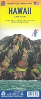 Wegenkaart - landkaart Hawaii - Honolulu + Hawaiian Islands | ITMB
This map represents a major change for ITMB. It is completely new artwork, using the latest satellite downloads, and is GPS compliant. The contouring is superb, the roads easy to …
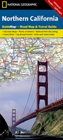 Wegenkaart - landkaart State Guide Map Northern California | National Geographic
The front side is an easy-to-read road map with insets of: * San Francisco Bay Area * Stockton * Sacramento * Lake Tahoe * Redwood National and State Parks The …
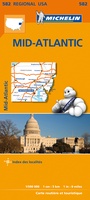 Wegenkaart - landkaart 582 Mid Atlantic - Allegheny Highlands - noordwest USA | Michelin
Zoals je van Michelin mag verwachten zijn het onmisbare overzichtskaarten van een uitstekende kwaliteit: een duidelijk en goed leesbaar kaartbeeld. Vrijwel alle berijdbare wegen staan er op ingetekend, in kleur …
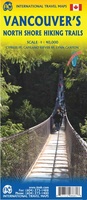 Wegenkaart - landkaart Vancouver's North Shore Hiking Trails - Fraser Valley | ITMB
Our popular map showing the recreational hiking trails in the mountains within the urban area of Metro Vancouver, but outside of its urbanized limits, continues into its most recent printing …
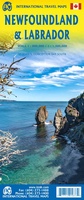 Wegenkaart - landkaart Newfoundland & Labrador | ITMB
Double-sided map of Newfoundland and Labrador Provinces at 1:800,000 and 1:1,300,000 respectively, part of a series of maps of Canadian provinces from the Vancouver-based ITMB, with topography presented by altitude …
★★★★★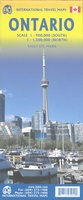 Wegenkaart - landkaart Ontario | ITMB
Een degelijke kaart voor Ontario met aanduidingen van o.a. nationale parken, vliegveld, benzinepomp, dirt-roads en kleine plattegrond van Toronto, Sault Ste. Marie. Als overzichtskaart goed te gebruiken. Ontario and Quebec …
★★★★★
- 1
- 2
- 3
- Volgende >>
- 21
Laatste reviews

Heb de gids cadeau gedaan en die persoon was er heel blij mee ..
★★★★★ door J 21 november 2024 | Heeft dit artikel gekocht
De kaart van Kirgystan is prachtig, zeer gedetailleerd. Kan niet wachten tot de we echt op reis hmgaan die kant op.
★★★★★ door Marijke Eering 21 november 2024 | Heeft dit artikel gekocht
Super handig fiets boekje en mooi water bestendig. En handig om op de kaarten te kijken heel duidelijk beschrijving. Wij fietsen al jaren in Duitsland …
★★★★★ door Jenneke holterman 19 november 2024 | Heeft dit artikel gekocht
prima kaart levering en betaling allemaal vlot verlopen
★★★★★ door Marc Buts 19 november 2024 | Heeft dit artikel gekocht